Blog Archives
The Pillboxes
On our day off a few weeks ago, Tory and I decided to hike up to the “pillboxes,” large concrete machine gun turrets installed after the attack on Pearl Harbor. We took the bus into Kailua and set out on a 30 minute coastal walk before arriving at the base of the hiking trail.
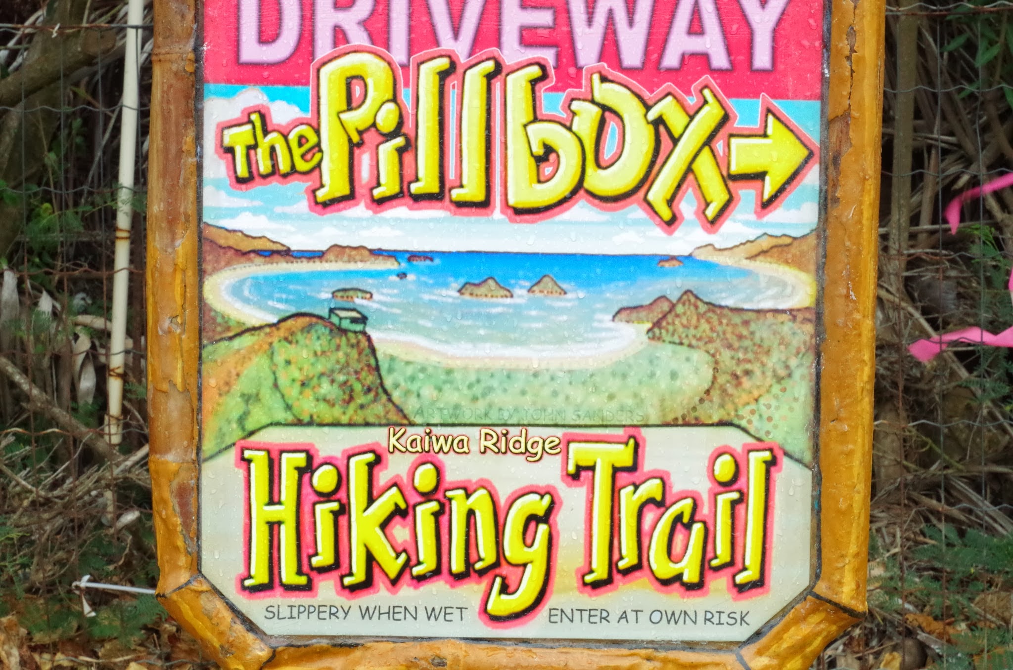
After a few minutes of hiking up a slippery slope, you can see the first of the pillboxes high up along the ridge. On the left is Kaiwa Bay (pronounced Kai – ee – va), and on the right is the town of Enchanted Lake. Once we climbed higher up, we could even see the mountain range that lies directly behind the farm.

As we get closer, there are some really spectacular views of the ocean. At this point we are almost to the first pillbox!

…and here is the first pillbox
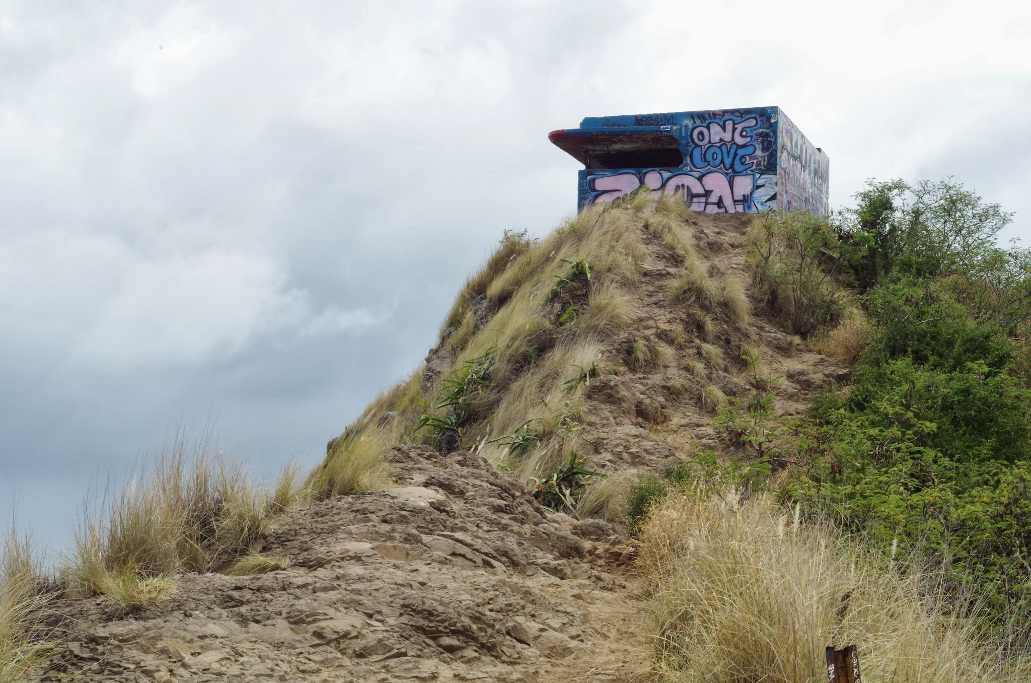
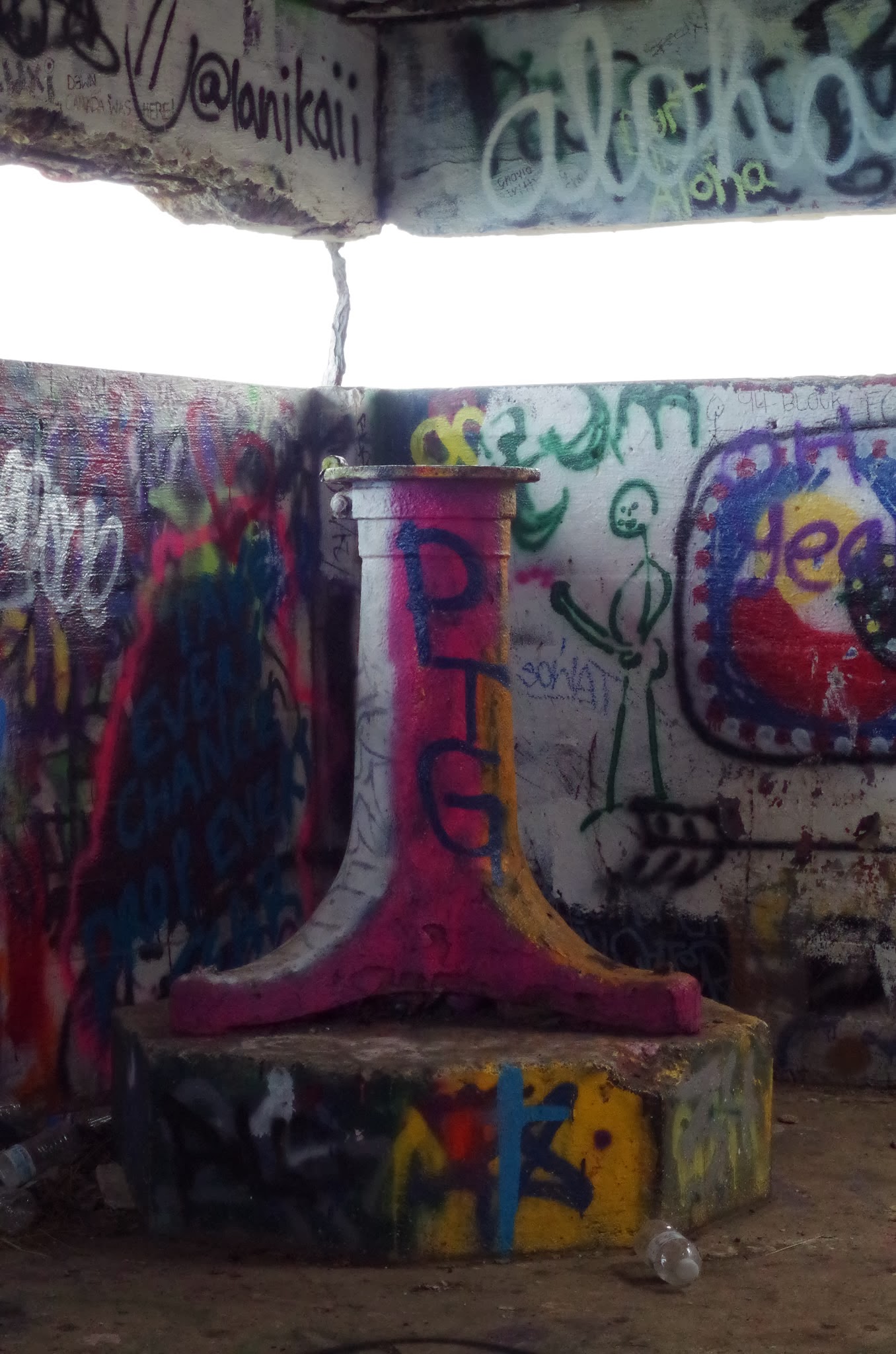
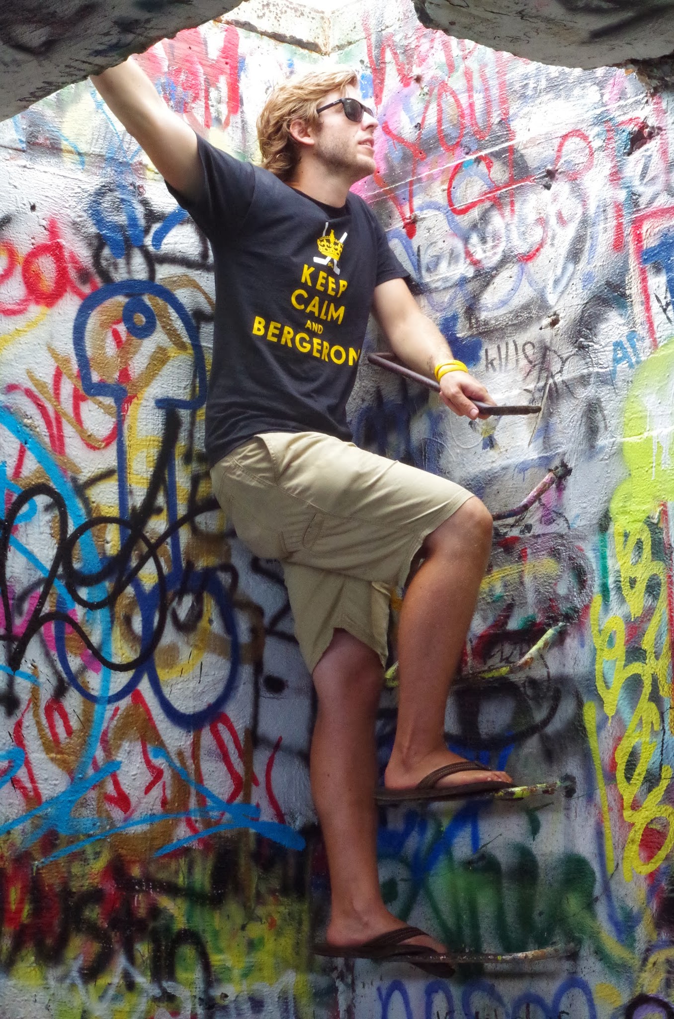
At first, I didn’t know what to think of the graffiti. However, I have since decided that it makes a seemingly ominous turret into something brighter (literally) and inviting. It even has its own Hawaiian appeal to it. After snapping this picture, we climbed inside to get a better look.
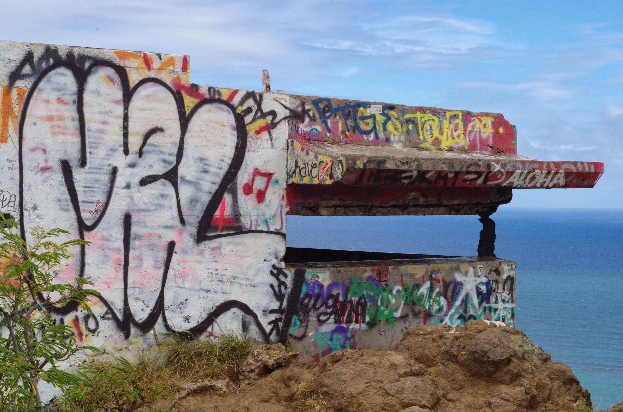
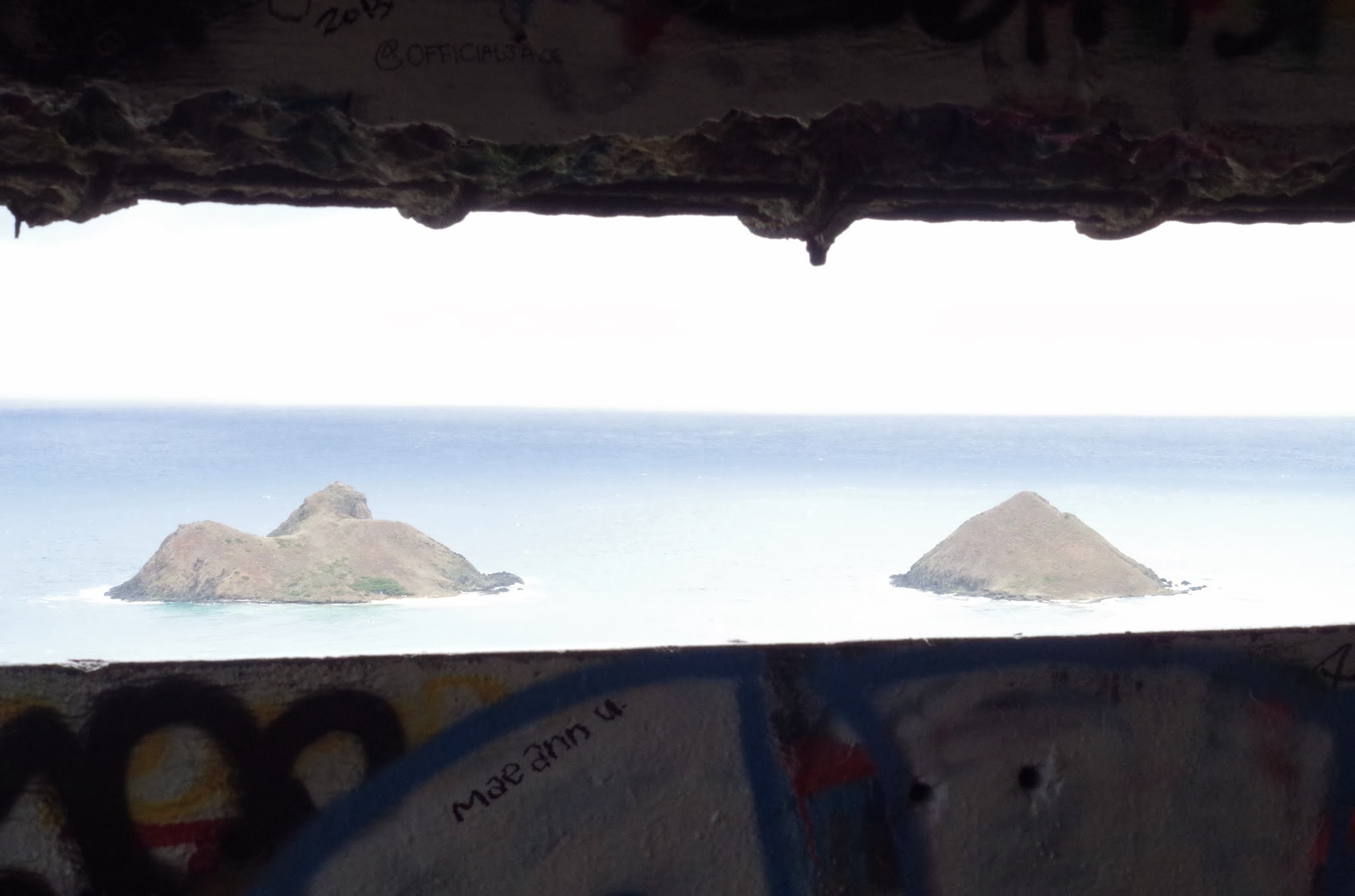
Here is the view out of the pillbox to the “Moks” islands. They are protected sanctuaries, but you are allowed on the outer rim of the bigger island, where other wwoofers have gone to do some cliff jumping. It’s fun to imagine that U.S. soldiers were once posted up in here looking out at this view for the Japanese invasion that never happened.
Then we climbed up to the roof…
…just in time to see the rain coming our way!

So we sheltered in the pillbox for a little awhile, and then quickly made our way down back to Kailua!
Tantalus Hike: Picture Tour
As a reward for working extra hours on the farm in preparation for Sunday’s Nalolicious Farmily Feast, John gave us an extra day off and took us on a hike through the Hawaiian rainforest. It was easily the most challenging hike I have done. That being said, it was filled with breathtaking views of the southern coast, Honolulu, Pearl Harbor and the Diamondhead crater. All in all, I couldn’t be happier that I was able to hike through the jungle for eight hours.

After we descended about 1,000 feet through slick mud, we came upon the first tufts of bamboo growing along the river that we would follow for the first 2 miles of the hike. Despite each stalk being only 2-3 inches in diameter, it was difficult to see more than 20 feet ahead. Bad idea to bring a backpack on this hike…

Next, we found the remains of an old Hawaiian village. The only part of the village still intact was the stone foundations of buildings and homes. John explained that the villages used to grade the hillside in such a way that they could grow Taro and use the natural flow of water to ensure that their crops were irrigated. Shortly thereafter, we came upon a big pile of stones called “The Mark of the Pig” that may have been a sacred site or a grave, so we were told not to touch it out of respect.
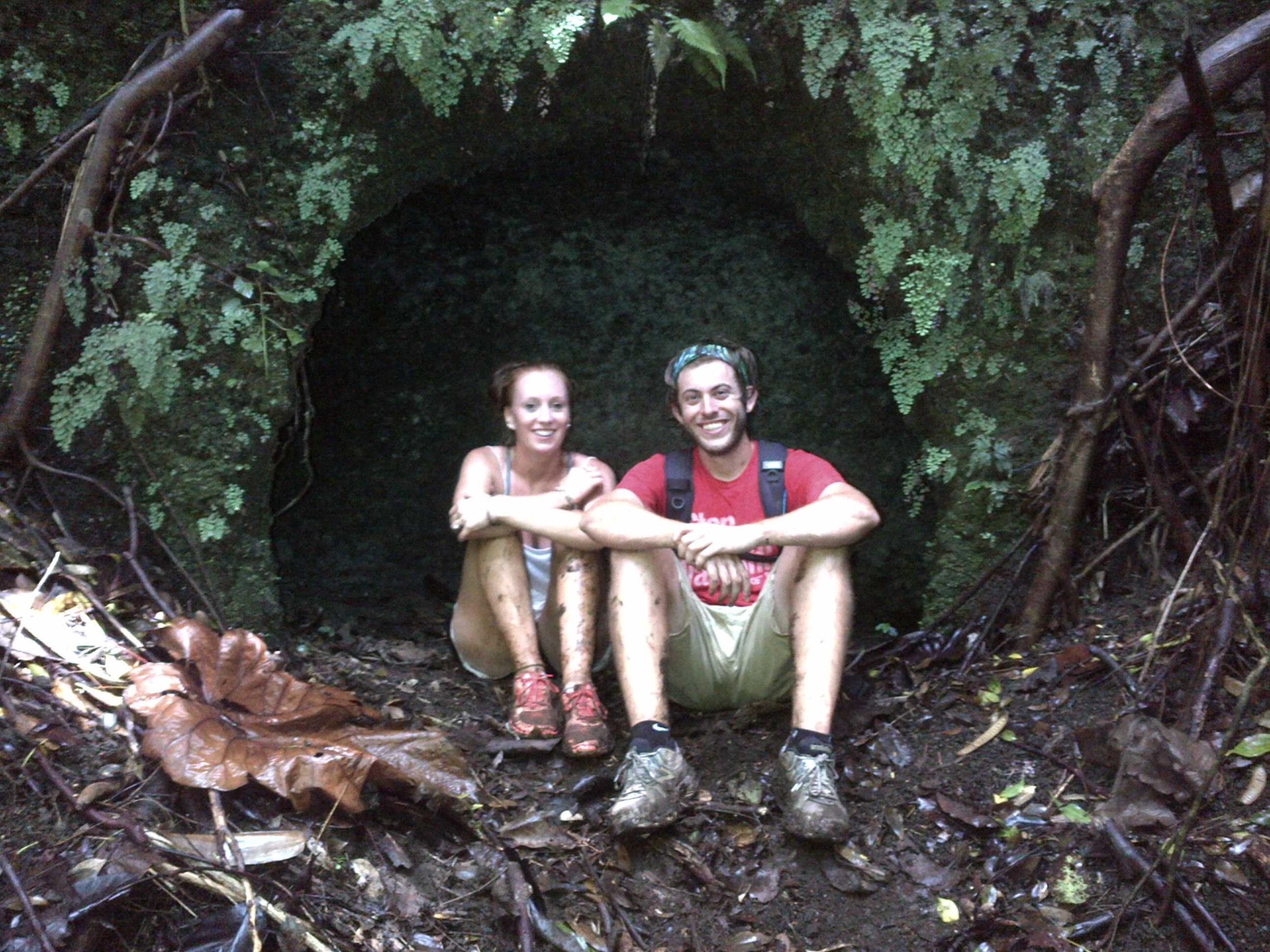
We began following the stream again, and as I was working my way up a muddy slope I lost the group. I looked ahead, looked back, and couldn’t find anyone (there were 11 farmers and two dogs on the hike). Then, hearing muffled laughter, I looked over to see a few of the farmers hidden in this little cave. Take a look at how wet and muddy we are at this point!
 Before lunch, the gradient decreased and the path widened out into this forest of eucalyptus trees. Supposedly, King Kamehameha had these planted in the 1880’s. A few of the trees were immense and a very beautiful deep red, which could easily be confused with California’s redwoods.
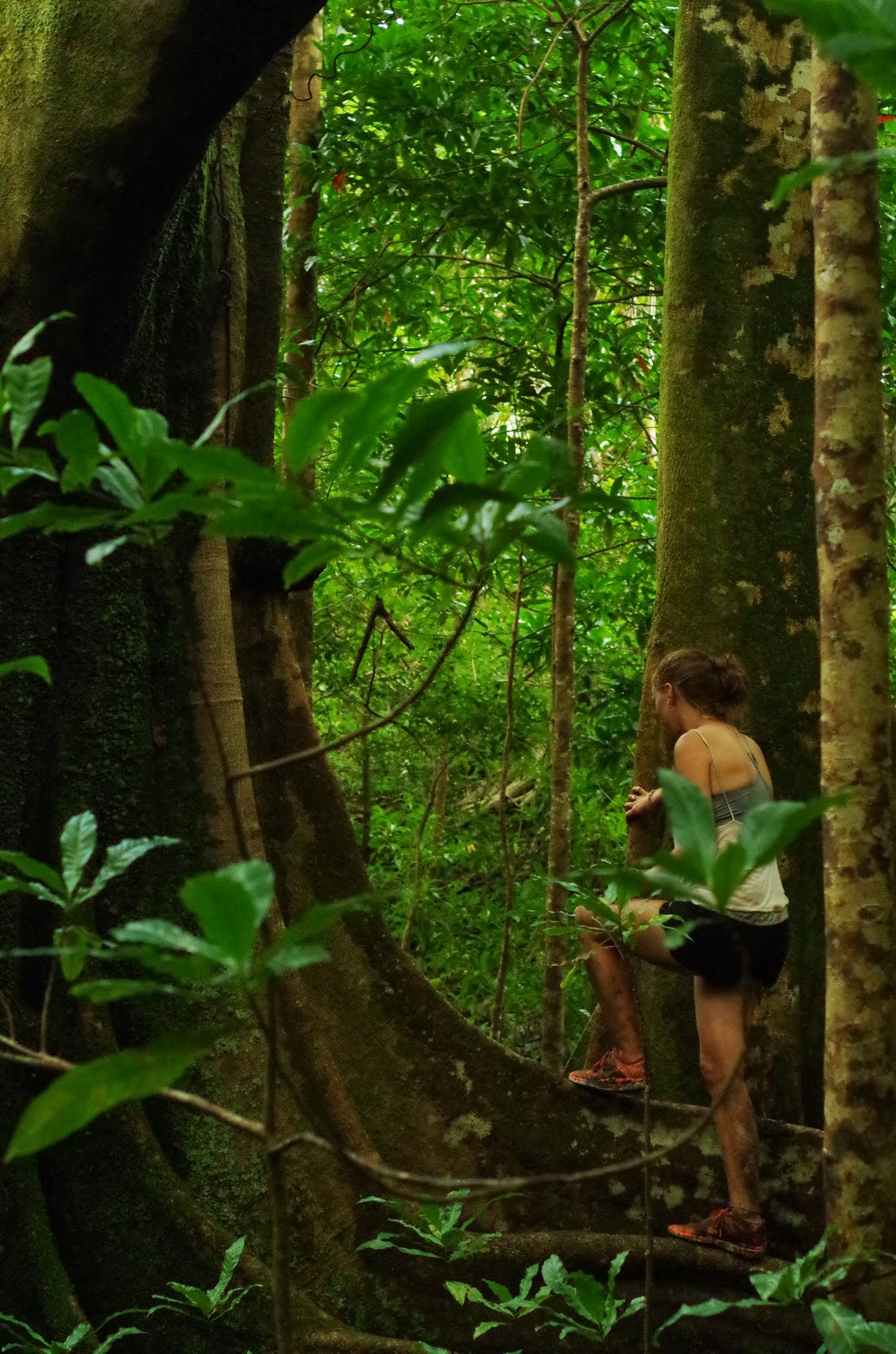
The next destination was a famous Blue Quandong, a tree straight out of the Jurassic era. The tree’s branches are shaped like a “U”, allowing us to climb into the branches and move up the tree with ease. Here, Tory is navigating around the enormous roots.

Wild coffee plants grow among the bamboo in the rainforest. I was told that it is time to harvest when the berries are red. Kona roast, anyone?

For the last 3 miles of the hike, we joined up with an actual trail that cut through the bamboo forest and up to the peak. Here I am (with Ben in the background) taking a breather on our way up the switchbacks to the top. If you find yourself in a bamboo forest, don’t put your full weight onto a brown stem. Trust me.
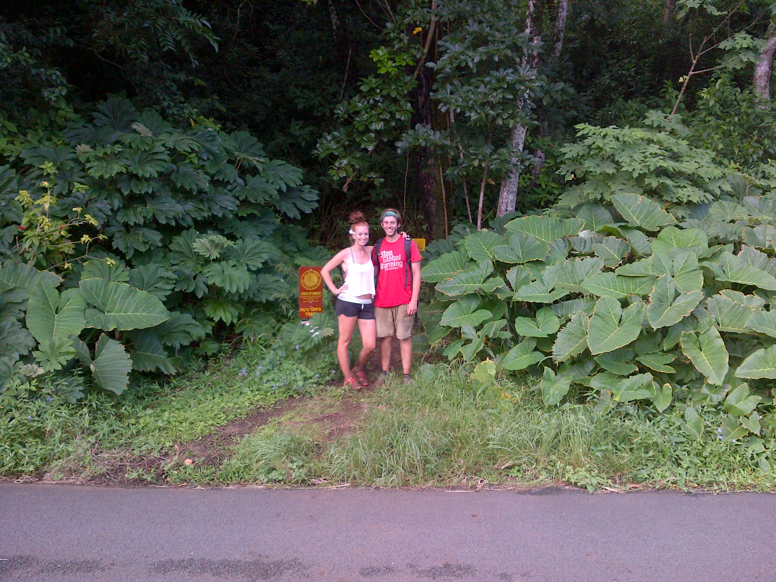
…and here’s the ending! The hike lasted just over eight hours. We descended 1,000 feet to the bottom of a valley, saw an old Hawaiian village, climbed back up through thick bamboo, descended 1,000 feet once again into a volcanic crater, climbed back up in the mud and finished at the top of Tantalus, where we began, Whew, I’m tired.
